
North Richland Hills ZIP Directory Coverage
North Richland Hills has two primary postal areas and three smaller intersections at the city edge. The city’s postal resource identifies 76180 and 76182 as the primary ZIPs, while portions of the city also fall within 76117, 76148, and 76053. Those five entries describe delivery geography. They should be read alongside the municipal boundary and parcel records, especially near neighboring Hurst, Haltom City, and Fort Worth postal labels.
| ZIP | Areas Covered | Post Office | Notes |
|---|---|---|---|
| 76180 | Primary North Richland Hills area, including central and southern sections | Davis Boulevard Post Office, 6051 Davis Blvd., North Richland Hills | Primary postal city is North Richland Hills |
| 76182 | Primary North Richland Hills area, including northern and eastern sections | North Richland Hills postal service; station assignment was not separately located | Primary postal city is North Richland Hills |
| 76117 | Small North Richland Hills section | Postal city commonly Haltom City | Postal and city boundaries do not match here |
| 76148 | Small North Richland Hills section | Postal city commonly Fort Worth | Postal and city boundaries do not match here |
| 76053 | Small North Richland Hills section | Postal city commonly Hurst | Postal and city boundaries do not match here |
The five-area pattern is why the ZIP code directory should not be treated as a city-limit list. Tarrant County’s ZIP and voting-precinct map, effective January 1, 2024, places all five within the regional geography. It does not convert a postal label into a municipal-jurisdiction finding.
North Richland Hills Primary ZIP Codes
The city calls 76180 and 76182 its primary postal areas. 76180 includes City Hall and the Davis Boulevard post office, while 76182 serves northern and eastern parts of North Richland Hills and many newer subdivisions and property-owner associations. Primary status is useful when checking a local mailing address, but each record system still needs its own location field checked.
See the city’s North Richland Hills post office resource for the local postal coverage statement and Davis Boulevard office information.
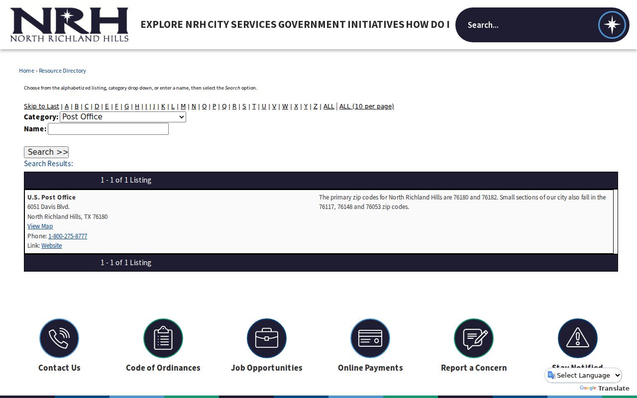
The city resource is a useful first check for the five ZIP intersections. It also makes clear that a primary postal label and the city line can answer different questions.
When a parcel is close to a municipal edge, save both the delivery address and the property’s city field. A mailing city can differ from a tax jurisdiction, city-service boundary, voting district, or the legal place described in a deed.
North Richland Hills Edge ZIP Codes
The smaller North Richland Hills sections in 76117, 76148, and 76053 are the local geography caution. Their common postal cities are Haltom City, Fort Worth, and Hurst, respectively. That does not remove a parcel from North Richland Hills, and a North Richland Hills postal label does not by itself place another parcel within the incorporated city.
North Richland Hills shares edges with several Mid-Cities communities. City limits, school districts, precincts, postal city labels, and tax jurisdictions can therefore diverge. Start with the full street address, then compare the city limits layer, the Tarrant GIS parcel, TAD’s Property City, the deed legal description, and the relevant voter precinct when the exact jurisdiction matters.
North Richland Hills ZIP Research Steps
A ZIP helps narrow a location question, but the next tool depends on the record sought. The county voter lookup uses a ZIP only in its address or polling-location route. Its voter-file layout separately includes permanent residence and mailing ZIP fields. The tool does not offer an open street-wide voter search. A parcel lookup may begin with a complete address, account, owner, or georeference, then move to map and deed identifiers.
- Enter the complete street address in the USPS lookup to test delivery formatting and the postal ZIP.
- Compare the result with the North Richland Hills city-limits map and Tarrant County GIS parcel boundary.
- Open the TAD property record by its address, owner, account, or georeference and note the Property City, situs, mailing address, account, and legal description.
- Use the voter lookup for an individual registration question, or make a focused Texas Public Information Act request for existing records when a custodian maintains the needed data.
- Once a postal area is narrowed to a street, use the North Richland Hills Street Directory for the address-keyed record trail.
Keep a note of which field came from which source. The postal address can be correct for delivery while the parcel or election system records a different geographic classification.
ZIP Directory Search Limits
The Tarrant Appraisal District basic property screen visibly offers property type and search text, and its records can be reached by owner, address, account, or georeference. The captured interface did not expose a stable ZIP filter. That is a research gap, not evidence that the TAD system supports ZIP-wide filtering. Confirm the live Advanced Search behavior with TAD before relying on a ZIP-only query.
Tarrant GIS map layers and the county ZIP map help compare the parcel with postal geography, but dynamic parcel-to-ZIP behavior was not confirmed in the inspected capture. The NRH Archive Center uses keyword, archive category, time period, and date range, not a documented ZIP filter. A city request may seek existing address- or ZIP-scoped permit or code records, but it cannot require the city to build a new resident list.
The voter system has a similar boundary. Its public lookup takes last name, first name, date of birth, or State Voter ID for an individual result. ZIP appears in the address and polling-location route, and the fuller voter-file layout has separate permanent-residence and mailing fields. A ZIP result therefore needs the same care as a parcel search: identify the record field, the effective date, and any confidentiality rule before using it as a location clue.
When a record cannot be retrieved online, a written request under the Texas Public Information Act should ask for existing records by the known address, date range, or documented postal area. The government body may clarify or narrow the request, but it does not have to create a report, conduct research, or answer a question about a person. Inspection alone is ordinarily free, while copying can have permitted charges.
Note: A documented filter is not the same as a record set that proves every person associated with an area.
North Richland Hills ZIP Boundaries
The United States Postal Service uses a complete address to test deliverability. That is the most direct way to confirm a street’s postal ZIP, but it is not a city-limit test. City incorporation is better checked through the municipal map, Tarrant GIS, TAD Property City, voter precinct, and the legal description in the deed. This sequence matters most for a North Richland Hills edge address carrying a Hurst, Fort Worth, or Haltom City mailing label.
Use the USPS ZIP Code Lookup with the full street address, rather than a ZIP alone, when checking delivery geography.
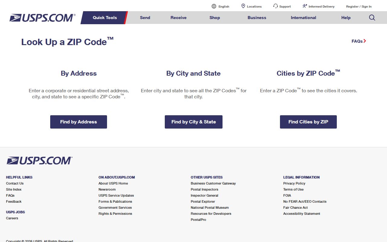
The USPS lookup is the delivery check in a three-way comparison with the county ZIP map and parcel records. It should not replace the city boundary or recorded legal description.
- ZIP and ZIP+4
- A five-digit postal area can be refined by a four-digit add-on for a smaller delivery segment or address range.
- PO box ZIP
- A postal area assigned to box service, which is not evidence of a physical parcel location.
- Unique ZIP
- A ZIP assigned to a single organization or destination; none was identified in the North Richland Hills research.
- Carrier route
- A delivery route used by the postal system, not a municipal boundary or a resident list.
North Richland Hills Address Fields
Several addresses can appear on one property trail. The situs address identifies the physical parcel. The mailing address identifies where tax notices go. A legal description identifies land through subdivision, lot, block, survey, or abstract. The postal city and ZIP identify delivery geography. A record may use one of those fields without using the others.
TAD’s account or georeference is the appraisal key, the County GIS polygon is the spatial key, and the recorded instrument is the legal source. A street number can change while the lot, block, or survey stays stable. Preserve all three identifiers when comparing an edge parcel with a postal label.
North Richland Hills Historic Postal Names
Older place names can complicate a modern address search. North Richland Hills began as a rural farming and ranching area, incorporated in 1953, and annexed Smithfield by 1960. Smithfield is the city’s oldest historic area and lies between Davis Boulevard and Smithfield Road, north of Loop 820 and toward Mid-Cities Boulevard. A historical search may need Smithfield, North Richland Hills, Richland Hills, Hurst, or Fort Worth as place variants.
No official source located a citywide readdressing year. Do not convert a modern street number into an older one without a plat, deed reference, city map, or clerk confirmation. For an older parcel, use the subdivision, lot and block, survey, nearby intersection, and county GIS geometry to bridge a postal-city change.
ZIP Directory Verification
The strongest location check combines postal, map, and record evidence. USPS tests the complete delivery address. The city and county maps test the boundary. TAD and the County Clerk records test parcel and legal identity. The voter system can add a registration-specific result when public fields permit it. Each layer has a separate purpose, which is why a single ZIP label is never enough for a precise conclusion.
The North Richland Hills ZIP code directory is most useful when it keeps those layers distinct. Compare dates too. Road work, development, platting, postal labels, and database updates do not necessarily occur at the same time. For city permit, inspection, code, or archive records, use the exact address and date range rather than assuming a postal area will retrieve the right file.